
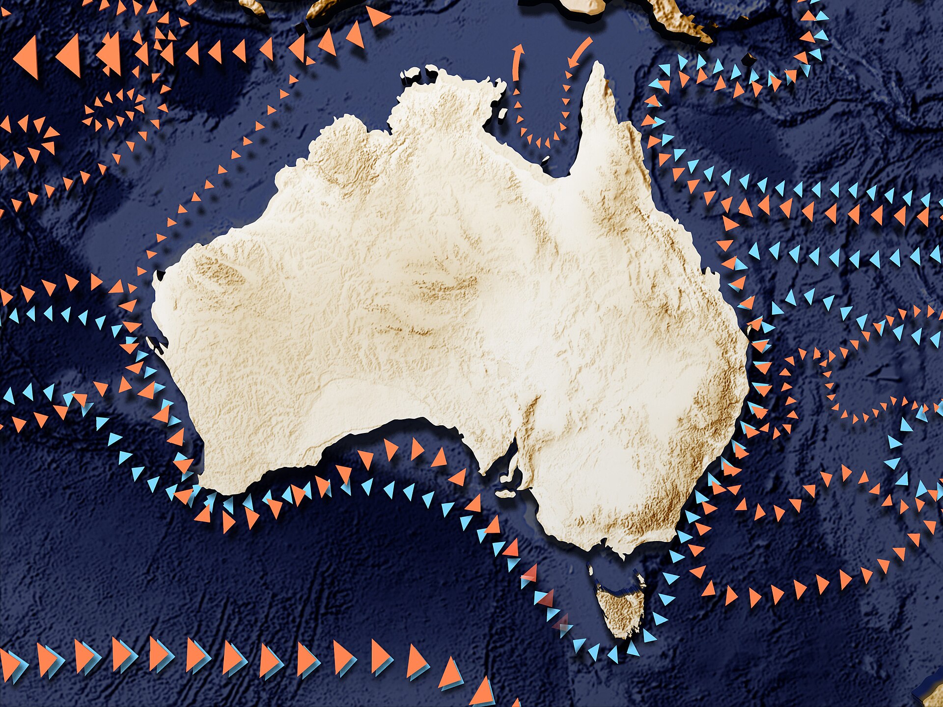
Ocean Currents Are Shifting, and Coasts Will Feel It First
The great ocean currents are the planet’s plumbing, moving heat, salt and nutrients around the globe in vast slow loops. Scientists have long suspected that parts of this system are weakening as the climate warms, and a growing body of measurements now suggests the changes are real, measurable and arriving unevenly around the world’s coastlines.
This is not a story about a sudden shutdown, whatever the headlines imply. It is a story about gradual shifts in temperature and salinity that alter where storms draw their energy, where fish thrive, and how fast sea levels rise in particular places. Those local differences are exactly what makes the science both important and difficult to communicate.
What the instruments are actually showing
A network of robotic floats, moored sensors and satellite altimeters now watches the oceans in near real time, a transformation from the era when a single research cruise provided a snapshot once a decade. The data show surface waters warming, freshening in some high-latitude regions as ice melts and rainfall patterns change, and becoming more stratified, meaning warm and cold layers mix less readily.
Stratification matters because mixing carries oxygen and nutrients between the surface and the deep. When it weakens, marine ecosystems feel it first, from plankton blooms that arrive at the wrong time to fisheries that shift polewards faster than the fleets and ports built to serve them. Research groups summarised by NASA have tracked several of these signals converging over the past decade.
Why some coasts face faster sea level rise
Sea level does not rise like water in a bathtub. Currents pile water up against some coasts and draw it away from others, so when a current slows or shifts, the water redistributes itself. A weakening western boundary current can mean measurably faster sea level rise along the coastline it once held back, on top of the global average from melting ice and thermal expansion.
For planners, that regional detail is the whole point. A sea wall, a port upgrade or a flood defence designed around a global average may be badly wrong for a specific estuary. Engineers increasingly ask oceanographers not whether the sea will rise, but how the local pattern of currents will change the answer for their stretch of coast. More reporting sits in our science section.
Uncertainty is not the same as ignorance
Climate models disagree about the pace of change, and honest scientists say so. The deep circulation is hard to observe, natural variability is large, and a decade of data can mislead. But disagreement about timing is not disagreement about direction: the physical reasons to expect change, from melting ice to shifting winds, are well understood and increasingly visible in observations.
The practical response is monitoring and flexibility. Tide gauges, floats and satellites are comparatively cheap insurance, and coastal plans that can be raised, extended or redesigned as evidence firms up are far safer than fixed bets on a single projection. The ocean is changing on timescales that reward those who watch it carefully.
None of this will announce itself in a single dramatic season. It will arrive as slightly higher floods, slightly different fisheries and slightly costlier insurance, compounding year after year. Understanding the currents is therefore not an academic luxury; it is the background knowledge every coastal community will need. Start with the overview on our homepage.
Fishing communities often notice the changes first, when familiar species appear in unfamiliar waters.
Each new year of float data narrows the uncertainty a little further, turning suspicion into measurement.
The evidence base is still growing, and researchers are careful to separate what is demonstrated from what is merely plausible at this stage.
For readers trying to judge the headlines, the useful question is always the same: what changed, who measured it, and how large is the effect in ordinary terms?
